World Map Path Finder
Pathfinding visualizer using OpenStreetMap data to demonstrate shortest-path algorithms on real-world maps. Built with Django, DRF, and React.
Last push
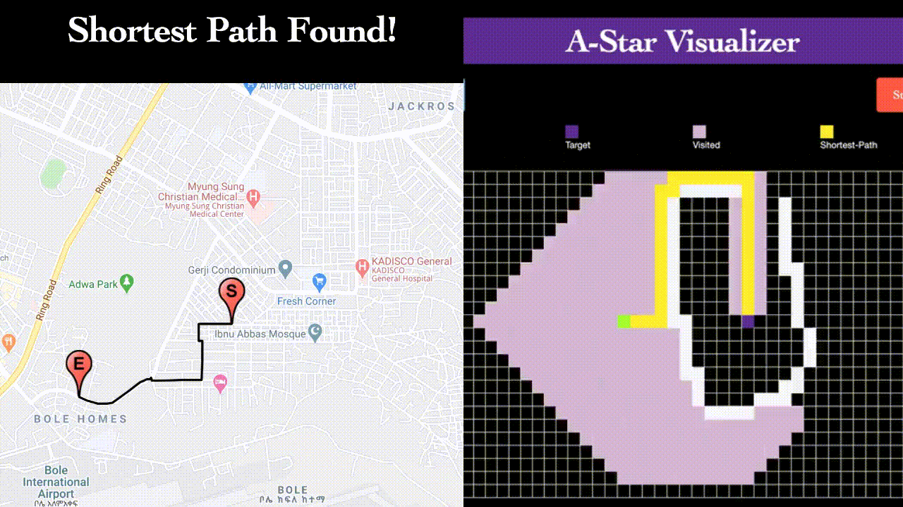
An interactive pathfinding visualizer that demonstrates classic graph algorithms (Dijkstra, A*, BFS, Greedy-First) on real-world map data from OpenStreetMap. Built with Django, Django REST Framework, and React, this project allows users to select start and end points on a map and watch the algorithms find the shortest path in real-time.
The visualization compares algorithm performance and accuracy against Google Maps' routing. Originally developed to explore pathfinding in Addis Ababa, Ethiopia (where I grew up), it now includes areas in Maryland and New York. Features a full-stack architecture with geospatial data processing and interactive frontend animations.